Part Two - Mill Ruins
After a somewhat disappointing dead end on the ROW detailed in
Part One, we were soon amply rewarded at our next stop.
We located both the
Planing Mill and the
Union Bag and Paper Mill complex.
 |
Valuation Map courtesy of Gino DiCarlo
and the Saratoga Springs Public Library History Room. |
Planing Mill
The remnants of the
Planing Mill were at the top of the hill.
 |
Valuation Map courtesy of Gino DiCarlo
and the Saratoga Springs Public Library History Room. |
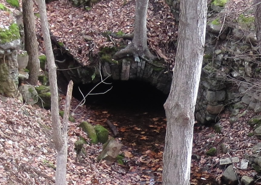
The descent down the hill was amazing because, as you got near to the bottom, the full array of the
Union Bag and Paper Mill complex was revealed. It felt like we had just discovered King Tut's tomb! :-)
Glen Sulphite Pulp Mill
The valuation map helped decipher some of what we found.
 |
Valuation Map courtesy of Gino DiCarlo
and the Saratoga Springs Public Library History Room. |
 |
| This massive millstone was the coolest discovery! |
Once again after exploring the ruins, we tried to continue north on the old RR ROW but were unable, so a jaunt a bit further northward in the car brought us to the next spot.
Axe Mill (Ballston Pulp & Paper)
Isaah Blood had built quite an extensive complex that straddled both sides of the river.
This location had a tragic fire-plagued history - the last incarnation was Ballston Pulp & Paper. Details in the link "Bloodville - Ballston Pulp & Paper" in the Further Info section below.
 |
Valuation Map courtesy of Gino DiCarlo
and the Saratoga Springs Public Library History Room |
 |
| Close up (from the photo above) |
 |
There were quite a few of these circular stones built into the stone walls.
Decorative or functional? |
Across the creek was what appeared to be remnants of a sluiceway... (
Bing Aerial >)
 |
| Sluiceway? |
 |
| Sluiceway? Bing Aerial |
 |
 |
| The ROW going south |
|
 |
| Gino on the ROW going north |
 |
| The ROW dead ended going northward so "back to the car!" |


No comments:
Post a Comment