Biking

"In the field" railroad history adventures...
Showing posts with label Hudson Valley Railway. Show all posts

Thursday, October 22, 2020

Trolley Bridge - Dionondahowa Falls

The Hudson Valley Railway was an extensive interurban electric railway system that was in existence from 1901 to 1925. (see map). There was a branch from Schuylerville to Greenwich that has been often overlooked. A few scattered remnants remain and old maps and postcards help reveal its history.

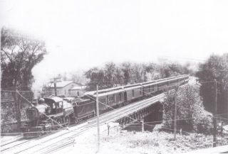
Especially impressive was the high spindly bridge that passed over the Dionondahowa Falls near Middle Falls, NY. Dionondahowa is a Native American Algonquin word meaning "She opens the door for them".  Source: Aboriginal place names of New York

Hudson Valley Railway Trolley Map

1 - Piers of the Trolley Bridge across the Battenkill at Clarks Mills are still standing 
Source

2 - Any remnants of the trolley bridge further upriver at Dionondahowa Falls have long disappeared
Dionondahowa Falls - Yesteryear and Today


Friday, January 1, 2016

Trolley History Tour - Ballston Spa


Ballston Spa has an interesting history of trains and street cars. At one time, it was serviced by three trolley lines and the railroad. Now of course the large curved embankment long since abandoned by the Delaware & Hudson (D&H) dominates the landscape but there are vestiges of the trolley lines around town as well if you know where to look.

On Dev 26th, before we ventured up the Kaydeross Valley in search of the old mills, Gino DiCarlo took me on a quick loop thru town. Knowing my interest in the trolley era, he wanted to point out a few “not so obvious landmarks” of once omnipresent street car lines.


Map Overview

The map below illustrates the various railroad and trolley lines including the now filled in river and "the island."
Base Map from http://www.openrailwaymap.org

Walking Tour

A walk up the short hill on Prospect Street gave us a glance at how the Kaydeross Railroad (KVRR) came in thru the town. Bath Street was the old electric railroad’s right of way. 
At the old Union Mill - looking south
This is Bath Street - built on the ROW of the Kaydeross Trolley 

We strolled on by the old Tannery...
This was once a thriving industry
...and Gino pointed out where the Schenectady Railway (SRW) snuck across what is now just an insignificant driveway to descend onto Washington Street.
Note ascending pavement - this was the route of the SRW
The old Hudson Valley Railway (HVRW) offices still stand proudly on Front Street but apparently the SRW wan’t allowed to connect with its competitor at this location. 

The two lines came close at the corner of Milton and Washington but never connected! Only when the D&H bought and merged them was a direct connection finally made!
Today
Yesteryear (from the Gino DiCarlo Collection)

Curious cement abutments right over Gordon Creek by the old hot dog place indicates where the SRW crossed and the abutments parallel to the Mechanic Street Bridge over the Kaydeross Creek are remnants of it’s continued route northward.
Looking east from Milton Avenue over the Gordon Creek crossing
Why is this strange short cement wall here? It was where the SRW crossed!
Mechanic Street Bridge
The abutment was where the SRW crossed
A dam and cement remnants at the Mechanic Street bridge are vague reminders of the early mills here

The Now Missing Island

What’s equally fascinating is that a sizable chunk of this area was actually an island replete with a foundry and a mill - appropriately named “Island Mill.” 
This view is looking east from the Rt 50 bridge over the Kaydeross -
 the area to the right was once an island!
Mills highlighted in green

What Happened to Galway Street?

Galway Street was once a rail yard.
Note Rail Yard and Turntable
See the view now -  Google Street View > 
(Galway Street at Science St intersection - looking east)

Take a Google Street View Tour

Bath Street 
At the Mills - North
https://www.google.com/maps/@43.008087,-73.8510289,3a,75y,23.9h,89.07t/data=!3m7!1e1!3m5!1sD_TIOw2XcJ9YQgexs5o_Aw!2e0!6s%2F%2Fgeo2.ggpht.com%2Fcbk%3Fpanoid%3DD_TIOw2XcJ9YQgexs5o_Aw%26output%3Dthumbnail%26cb_client%3Dmaps_sv.tactile.gps%26thumb%3D2%26w%3D203%26h%3D100%26yaw%3D95.748642%26pitch%3D0!7i13312!8i6656

At the Mills - South
https://www.google.com/maps/@43.008087,-73.8510289,3a,75y,207.23h,82.17t/data=!3m7!1e1!3m5!1sD_TIOw2XcJ9YQgexs5o_Aw!2e0!6s%2F%2Fgeo2.ggpht.com%2Fcbk%3Fpanoid%3DD_TIOw2XcJ9YQgexs5o_Aw%26output%3Dthumbnail%26cb_client%3Dmaps_sv.tactile.gps%26thumb%3D2%26w%3D203%26h%3D100%26yaw%3D95.748642%26pitch%3D0!7i13312!8i6656

The Tannery Alleyway
https://www.google.com/maps/@43.00397,-73.851308,3a,75y,218.26h,88.77t/data=!3m6!1e1!3m4!1sRo17tcW3Ai7yuZZrsB3jag!2e0!7i13312!8i6656

The Driveway Descent
https://www.google.com/maps/@43.0029997,-73.8512712,3a,75y,253.83h,71.54t/data=!3m6!1e1!3m4!1shJDD4-_oX-WMQjO5IvgoaA!2e0!7i13312!8i6656

Main Street - The Two shall Not Meet!
https://www.google.com/maps/@43.0033843,-73.8489061,3a,37.5y,12.28h,86.08t/data=!3m6!1e1!3m4!1s2P15OcFTPP6raQWkCZiTbA!2e0!7i13312!8i6656

HVRW Stop on Front Street
https://www.google.com/maps/@43.0024133,-73.85098,3a,90y,326.25h,90.29t/data=!3m6!1e1!3m4!1szYdvyHRZjjGYZtzk5N__ew!2e0!7i13312!8i6656

Milton Ave crossing Gordon Creek (SRW abutment remnants are here)
https://www.google.com/maps/@43.0048692,-73.8490806,3a,75y,123.46h,75.45t/data=!3m6!1e1!3m4!1s40WIuXqOMuH5cAMXhosy_Q!2e0!7i13312!8i6656

Mechanic Street Bridge Abutment


Saratoga County Picture Gallery

Direct Links to Timothy Starr's Historical Photos
Delaware & Hudson passing over the Kayaderosseras Creek
Source: http://ballstonhistory.angelfire.com/images/pic03.jpg
Delaware & Hudson through Ballston Spa
Note Turntable -- This was the approach to the Galway Street Rail Yard
Source: http://ballstonhistory.angelfire.com/images/pic10.jpg
Sans Souci Hotel, built in 1803 and torn down in 1887
Source: http://ballstonhistory.angelfire.com/images/souci.jpg

Further Recommended Reading


The Paper Bag King - A Biography of George West
http://ballstonhistory.angelfire.com/west.htm

Lost Industries of Saratoga County
http://ballstonhistory.angelfire.com/industrial.htm

Ballston Spa, New York (Wikipedia)
https://en.wikipedia.org/wiki/Ballston_Spa,_New_York)

Sunday, November 29, 2015

Abandoned Bridges at Moses Kill (Part Three)


Argyle Brewing Company - Greenwich

After visiting the Batten Kill Trolley Piers (previous post - Part Two), we headed over to Greenwich and stopped at the Argyle Brewing Company. It was a fantastic place. Gary and I tried their beer sampler and it was served in a carved log - how cool is that!
Carved log beer sampler - um um good!

We stuck up a conversion with the bartender and locals and it turns out I found a kindred spirit - an amazing photographer who loves to trek to exotic "off the beaten" path spots.
Michael's photos:
https://www.flickr.com/photos/bubblesandsons
Michael immediately called up his brother-in-law, Darren who is a total Urbanex advocate (a.k.a. Ruins Porn) and has traveled the world documenting every place imaginable including Chernobyl!
Darren's photos:
https://www.flickr.com/photos/nerradk

Darren joined us for the trek up to Moses Kill! He recommended a pizza place north of town for a quick lunch and then we drove back on Rt 29 and up Rt 4 (rather the Rt 77) to continue our exploring.

At Glen Road

This stop was a bust. Although the remnants of the old canal were discernible, the Trolley ROW was completely overgrown.  At least I did find a railroad tie in the bushes...


At Moses Kill

All the planned ways in to the old bridges were plastered with no trespassing signs so we trekked in legally thru incredibly overgrown swampland/thickets on the north side of the Kill. It was tough going but the reward was great! :-)


Moses Kill - Champlain Canal Aqueduct

The old Champlain Canal crossed over the Moses Kill on a aqueduct and the stone work was incredible. 

Moses Kill - Trolley Bridge

There was still an arduous trek thru the overgrowth to get to the Trolley Bridge but it was quite picturesque in the fading light.
Bing Aerial View of Bridge

Here's a photo of it's construction
Construction Crew
Its remarkable how much it looks like the Willow Glen Bridge outside of Mechanicville.
See Photos >

Conclusion

From the railroad piers over the Hudson to the relics of the Paper Mill to the bushwhacking thru the dense overgrowth to see the Moses Kill Bridges, all in all it was an rewarding adventure!

Thomson Pulp and Paper Mill Ruins (Part Two)


Thompson - Across the River


After exploring Hudson Crossing Park (previous post - Part One), we drove to Northumberland and took Route 4 across the Hudson River. We went back down Rt 113 to Thomson to sniff out any vestiges of the old paper mill.  As the historical postcards below indicate, years ago there was a small village and the paper mill was quite substantial.

Thomson Pulp and Paper Mill
This area was once the site of the Thomson Pulp and Paper Company. Incorporated on June 11, 1888 it was later known as the Iroquois Pulp & Paper Co. It was sold to Georgia Pacific and closed in 1980.
1890 View of the Paper Mill
Thomson NY Pulp & Paper Mill c1910 Postcard
From the Gino DiCarlo Collection
1940 Topo Map
The Paper Mill is long gone but vestiges of the mill and railroad/trolley presence still remain
trackage (prior to the 1980 closing)

Exploring the Area

A - The North End
We parked at the north end and although the bridge (Z ) was blocked, a walk to X (see photos below) unveiled a way across the sluiceway at Y.
North End 
The north end trolley abutments
"X" apparently was the location where boats docked and unloaded their timber
The Bridge (at Y) looked like the "official" entrance as it was lined with gracefully shaped trees
As we trekked southward, we saw railroad ties still in the ground...
...and piles of the ties as well
B - At the Railroad Crossing

Bushwhacking thru the undergrowth to get to the railroad piers unveiled this old relic
(a signal perhaps?)
Looking back across the Hudson at the railroad piers
There was an old rail sticking up nearby
C - At the Trolley Crossing
The River was raging and has toppled some of the trolley piers
It was an an impressive sight, seeing and hearing the raging river cascading around the trolley piers. Super-Short Video:

The Railroad Piers are visible looking north

Stone Rubble where the Trolley Bridge started

Paper Mills Ruins

South of the Trolley Crossing there was a bit of the old paper mill still standing...
At the far end of the wall, the archway looked like an opening for water to exit via the sluiceway
If you look closely along the bottom of the wall there are additional arches
(More lower level sluiceways?)
We ventured into the foundation area to explore the ruins...
The old turbine! :-)
The archway was the exit for the water flow
Tree vs. Ruins
We left the foundations area and headed back north along the clogged channel which we figured was the sluiceway. The bridge I had spotted from the aerial satellite maps was for the road as parallel to it were the abutments for the trolley bridge
The old roadway bridge was still solid as a rock
Walking northward, we even found a rail in the ground! 

D - The Batten Kill Railroad Tracks

We said our goodbyes to the area and drove south towards the Batten Kill. We stopped briefly to photograph the end of the Batten Kill spur (now disused). These tracks at one point continued thru the paper mill and on across the river

E - Piers on the Batten Kill

It was a beautiful, serene stretch of the Batten Kill where we stopped to explore the Trolley Piers. Once again, a short trek thru dense forest undergrowth was required to get to the abutment but it was stunningly beautiful in the sunlight.

It was already after 1 pm and we were long overdue for a midday rest. We headed over to the charming town of Greenwich to visit the local brewery...

Next - Greenwich and on to Moses Kill