Part Three -
A Few More Mills, the Powerhouse, Boice Park Trails and the Bridge
After leaving the
Axe Mill site we continued northward.
County Farm Crossing
Our first stop was the County Farm Crossing. There used to be a road bridge here but it has been removed for quite a while. A short jaunt down the hill took us to the ROW.
 |
| ROW looking south |
 |
| ROW looking north |
National Mill
The
National Mill remnants were located on private property so a thorough hiking exploration wasn't "in the cards". But there were a few mill remnants easily visible--even using Bing aerials.
Sadly, we didn't get a chance to sniff out what appears to be the former dam across the creek.
 |
| Bing Aerial |
The Powerhouse
Next was a visit to what was once the Trolley's system's powerhouse, now restored as a lovely apartment building. Gino pointed out the bracket that held the trolley wires (it's a nice touch even tho' the tracks actually ran on the other side of the building...)
Historical Photo: Powerhouse (on the left) and Car barn (on right)
 |
| From the Gino DiCarlo Collection |
Eagle Mill
At the intersection of Rock City Falls Road and Sherman Road--at a designated Angler's spot--you can see the
Eagle Mill remnants.
What's perplexing about this spot is that it appears the creek has been rerouted to the east side of the mill subsequent to the mill's abandonment. The Valuation Map showed the main flow of the creek on the west side of the mill!
 |
Valuation Map courtesy of Gino DiCarlo
and the Saratoga Springs Public Library History Room. |
 |
| Eagle Mill - Craneville, NY |
 |
| Remnants of the dam are visible a little further downstream |
 |
| Panorama shows where the old path of the creek probably went |
 |
| There was a mysterious ruin lurking in the woods across the creek as well. |
Driveway
Following the Trolley ROW on old maps or Bing or Google aerials indicates the ROW veered from the road at this driveway.
Pioneer Mill
The
Pioneer Mill in West Milton was a spooky spot for me. The weather was darkening with a sky full of nasty gray clouds and it appeared (although we weren't sure) that someone lived on the grounds. I hastily took a few shots as Gino scoffed at my paranoia.
 |
Valuation Map courtesy of Gino DiCarlo
and the Saratoga Springs Public Library History Room. |
Railroad spurs
 |
| Looking south from the road - this was spur #1 |
 |
| Spur #2 |
 |
| This is a Google Street View of the Spillway |
Boice Park
Right up the road about 50 ft or so from the Pioneer Mill remnants was the mainline ROW. This has been designated as the Blue Trail (
Trail Map >). I plan on returning in the summer months to mountain bike it.
From the development, we hiked in going northward as far as we could...
But eventually the overgrowth was too much to navigate through...
Looking back at the ROW
It would be nice (depending on property ownership of course) if the trail could be developed and continue on to the bridge...
 |
| Enhanced aerial showing the ROW |
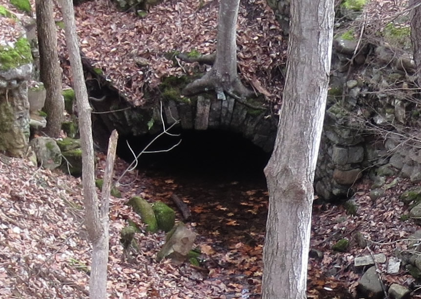
The Bridge
It was getting late in the day and increasingly darker so the last spot we explored was the trolley bridge on Heisler Road.
The ROW going northeasterly from Heisler Road
Trolley Stop
The Rock City Falls mills and whatever can found up at Middlegrove will have to wait for another trek but Gino directed me briefly to the trolley stop.
Other Photos:
It was a great trek and whetted our appetite for future explorations...