Sunday, December 25, 2016

Albany, NY (Historical Photos)

Well this is not really an outside adventure but it is railroad related so it best posted here.

Albany, NY

Christmas Day was spent with the family in upstate NY. We had the pleasure of dining together at Jack’s Oyster House in Albany, NY. The dining room was filled with historical photos and the old (former) D&H Headquarters in all its glory was just across the street…
Former D&H Headquarters
Schenectady Railway - Interurban
Albany Union Station

Grand Central, NYC

Later in the week, I was back home and on my evening commute through Grand Central Terminal, I decided to snap these two photos.

Vanderbilt Room 
Passageway between the Vanderbilt Room and Main Hall
Be Sure to check out other photos on the GCT page if you haven’t already:

Friday, December 23, 2016

FJ&G Remnants West of Scotia NY

The Fonda, Johnstown and Gloversville Railroad (FJ&G) was formerly a 132-mile steam engine and electric interurban railroad that connected Fonda, Johnstown and Gloversville to Schenectady, New York. It had a successful and profitable transportation business from 1870 until the 1980s.

I spent some time this afternoon documenting the remnants of this system between Scotia and Amsterdam NY.  The FJ&G ran along the north side of the Mohawk River and--although much of it has been obliterated by the widening of Rt 5--there were still a surprisingly good amount of places to see vestiges of the ROW.

Maps

These 1931 USGS topo maps indicate the precise ROW (highlighted in brown). It was a double track all the way between Schenectady and Amsterdam.


The FJ&G crossed under the New York Central mainline at Washout Road and turned westward.
Washout Road Underpass
Google Street View
On Google Maps, this is labeled as Simmons Road
Google Street View

Documenting the Right of Way (ROW)

At the foot of Washout Road, the abutment over the creek was much easier to see in the winter than last April when I scrambled thru the briars to snap photos.  see April Post >
Washout Creek

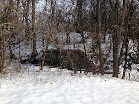
The widening of Rt 5 over the years obscured some sections but in other spots the roadway was easy to discern just to the north.

The three photos above are (1) view from the road; (2) a small culvert; and
(3) a climb up to view the ROW looking eastward
Certain sections of the ROW were visible in the distance
A turn up a side road permitted close ups

Verf Kill

Remnants of the bridge over the Verf Kill.
View from Rt 5
Up hill on a side street - I walked eastward on the rail bed cut 
Abutment
View down from the edge
Looking upstream
Looking westward on the same side road

Traveling further west


Visible in Bing Bird's Eye views
Another side road view

Further west, where the ROW ran closer to Rt 5, only a skinny width remains...

Abandonment

In 1938 the Gloversville to Schenectady line was abandoned.

Further Info

The Fonda, Johnstown and Gloversville Railroad (Wikipedia)
Gino's Rail Museum (in depth details: photos, history, etc.)
The Fonda, Johnstown & Gloversville Railroad (American Rails)
Washout Creek Bridge (Bridgehunter)
FJ&G Map

Tuesday, December 20, 2016

The Short-lived Mohansic Branch Controversy


Hospital for the Insane! Charles Wiley Murder! Concerns of Pollution! Controversial Project Abandoned!

The story of the short-lived Mohansic Branch is fascinating as the headlines above indicate...

In order to relieve the overcrowding of mental institutions in New York City, in 1909 the State Commission in Lunacy (yep that was the official name!) purchased 550 acres on Lake Mohansic with the intention of building an asylum to accommodate 2,000 (later 6,000) patients. The property was later expanded to 660 acres, with an additional 490 acres for the New York State Training School for Boys.
Mohansic Lake
In 1911, a spur from the New York and Putnam Railroad was built from Yorktown Heights and across Crom Pond to the asylum site. 

ITO Historic Railways Map
Downing Drive and Mohansic Avenue East were built on the rail bed
Progress was going smooth for a while… Construction of the hospital was underway, starting with three "cottages" which housed 165 inmates. But on July 4, 1913 19-year-old hospital attendant Charles Wiley, Jr, was murdered at one of the cottages.

Then in 1916, continued construction on the asylum became the subject of heated debate as concerns mounted regarding pollution to the New Croton Reservoir and the New York City water supply from sewage the asylum would produce. Eventually the the New York State Governor ordered construction stopped to protect the watershed, and in 1918 he signed a bill which abandoned the hospital project.

The railroad line was abandoned in 1917 and the property was converted to a state park in 1918. The land is now the FDR State Park.

Evidence - Aerial Views

I hope to get up there soon to sniff around the backwoods and take photos... Bing Bird's Eye Views uncover some of the old roadbed. https://binged.it/2i38Oqa  

Trailway

Good News! It looks look the old rail bed will soon be reclaimed as a trail way. The Proposed Mohansic Trailway route follows the town-owned abandoned railroad spur from Route 118 opposite Downing Drive to Baldwin Road it all eventually connect to trails in FDR State Park. Grant money has been allocated.
Proposed Trail

Further Info

Russ Nelson (a kindred spirit in Railroad Archaeology) posted photos here of what remains of the ROW (this was pulled from the comments section)

FDR Park History


Mohansic Trailway - Rail Trail to be built

Friday, December 16, 2016

Railroad Valuation Maps - Trestle Trail, RI

Back on August 19, 2016, I rode the Trestle Trail heading west from from Summit, RI. POST >

Summit, RI

Summit Station
Little did I realize that there once was a wye, just west on the starting point. See the area from a Bing Bird's Eye View: https://binged.it/2hQpcKS

WYE at Summit

Greene, RI

Greene
There isn't much left of the Town of Greene now, but it had a three track section back in 1916!

Source: Greene

The Trestle

Lastly, I found the valuation map of the trestle...
Source: Bridge (Trestle)

Further Info and Credits


HARTFORD, PROVIDENCE & FISHKILL
^The Historic Photos were sourced from this site

NYNH&H RR Valuation Maps
^ The valuation maps can be found here

Saturday, October 15, 2016

Copake Iron Works

After my Copake Falls Bike ride on the Rail Trail, I rode my bike up into the Taconic State Park and checked out the ruins of the Copake Iron Works. It was a fascinating display of the iron making industry that was the economic backbone of this area back in the late 1800s. The IronWorks had their own narrow gauge railroad, built in 1862, to move goods to and from the furnace and bring completed cast-iron goods to Copake Station.


  Blast Furnace

 Museum

 The small museum even had a very nicely done diorama of the area.

 Photo of the Main Line Train Station (now the Deli)

 The Narrow Gauge Railroad

the narrow gauge rr ran here

After this visit,  I headed back south to research finding vestiges of the old ND&C west of Millerton.